Location

At the foot of the Serra da Cabreira

Rua do Monte Castelo, Rossas, Vieira do Minho, Braga district.

Portugal · North

Rossas · Vieira do Minho

The maps show the approximate region of the property (circle, 2 km radius). The exact location is provided in the investor portal.

Flyover

The land from above

Two minutes over the property and the surrounding valley, in Rossas.

Drone footage of the property. Watch the full version ↗

Braga

± 45 km ~45 min

Guimarães

± 38 km ~44 min

Porto

± 105 km ~1h20

Driving distances by route (OSRM) from the land's reference point — rounded, not live-checked against Google Maps.

Territorial context

The two fronts carry different classifications in the Vieira do Minho municipal plan. On the village land, part of the ground is classified as Espaços Urbanos de Baixa Densidade — low-density urban land, in the strip beside the houses and the municipal road — and the remainder as agricultural space. The upper land is entirely rural.

Classifications consulted in the geographic information system of the Vieira do Minho municipality (functional land qualification chart). They state how the land is classified, not what may actually be built — that depends on a formal urban-planning opinion, still to be obtained.
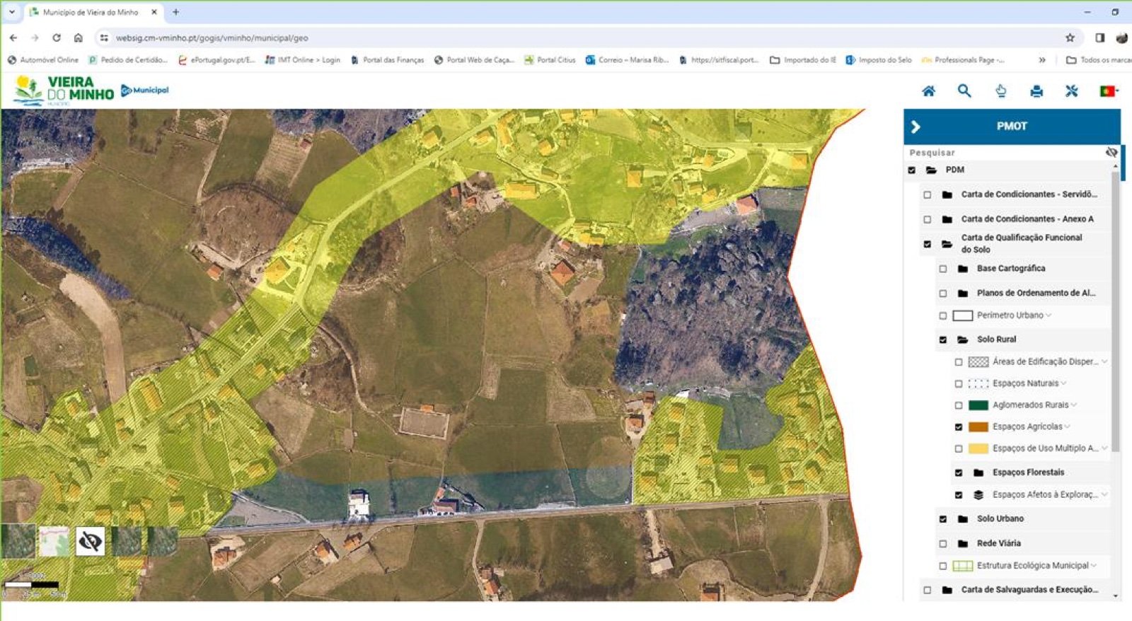
Screenshot of the Vieira do Minho municipal GIS (PMOT), showing the land classification for the property area
Screenshot of the municipal GIS (Vieira do Minho PMOT).